Upload raster or vector property maps?

Joined
Dec 2, 2007
Messages
6
I'm thinking about buying a TomTom One 3rd edition, but first wanted to know...

Can I upload custom maps, in either raster or vector format, that I can then pin down using the GPS to tag each point, thus defining scale/orientation?

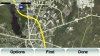
My goal: I purchased a 90 acre parcel of land and I want to take the survey map and import it into a GPS device, tag the main boundaries so that I can put it in the correct scale and orientation, and then be able to wonder around on the land and know where I am, add points of interest, be aware of when I cross over the property boundary, etc.

I would imagine this kind of feature would be very helpful for other purposes as well, such as mountain biking trails, etc.

If this isn't possible on a TomTom One, or other model, any alternative device suggestions would be greatly appreciated. Also, as an alternative, can I plug the TomTom into my laptop via USB and use a program on my laptop to plot my location, etc. as I described?

Thanks for any feedback!
 
I think you could do something like that on most GPS - for what it's worth. I also own wooded property adjacent to a state forest and have experimented with different approaches. But just realize that all consumer GPS'es aren't accurate enough for real surveying. You could easily be off by anwhere between 20 and 50 feet. Just try marking waypoints on different days at the same location, you'll see a scatter pattern.

Basically you can create a waypoint for each corner of your property. I'm using a Garmin GPSMap60csx for this sort of thing now. After creating all the waypoints I just made a route which passes through each one, returning to the first at the end. That has the effect of drawing the outline of my land on the screen.

Not sure what would happen if you did this on a TomTom since they're more intended to navigate in cars. See the threads about using Google maps. You could build the route there using ariel photos.

If you can visit each corner of your land and set a waypoint then that makes it easier (although maybe not as accurate). In my case, not all my corners were surveyed, but I was able to construct where they are using Google Earth and my deed.

I don't know any way to load a raster image on the TomTom and have it display as a map, but that doesn't mean it doesn't exist. In the end, I think you'll find that a handheld GPS intended for outdoor use will be better suited to what you want. Garmin and Magellan also offer topographic maps which may be more helpful than TomTom's street maps.

BTW - the 3rd edition evidently doesn't have a menu option for Itineraries, which is what you would need for the technique I described of drawing your property outline. See the thread about Google maps somewhere around here. There's a hack you can use to enable itineraries. Still, it's probably not the best tool for your job.
 
Last edited:
Thanks for that reply Boyd.

I'll probably buy the TomTom and give your approach a shot. The 3rd gen is on sale for $150 right now, so worst case scenario I'd have a nice little GPS for my wife's car at a great price.

Thanks again...

If anyone else has any suggestions re: loading vector/rastor images please let me know.
 
I'm not sure if this application would be of any use - it certainly runs on a TomTom.

Wayne

That application also allows fro the use of maps in a BMP format. I have seen a program someone made that will take a bmp file and set it up correctly to use on the one. You just need to know the coordinates of each corner of the BMP.

here is that other program https://www.tomtomforums.com/showthread.php?t=3958

also the off road application works much better on version 6 of the tomtom OS.
 
Last edited:
That's pretty cool. Too bad my windows machine died recently so I can't check it out at the moment :(

Right out of the box the 720 and 920T (probably other models as well) can display very low resolution satellite images. Turn on Images in the Options menu in the on the Browse Maps screen. When you zoom out to the 30 mile scale the map will change to a satellite image (which looks very out of focus and bad).

The images themselves are stored as .jpg files in the /raster directory on the GPS and have a companion text file which must be somehow used to locate and scale the image. Here's an example text file:

% cat usaw03_-16812,05667.sat
-
-168.12500
71.25000
-152.50000
56.67500
1000
15000
1250
1166

So does anyone know how this works? The images seem to be of varying sizes. I'm guessing the poor quality has to do with a bad scaling algorithm for fitting the image to the screen because there's more than enough detail in the files to look good on a little screen. Are the images hard-wired to the map such that they only display at the 30m zoom level? Or is there a way to upload your own high res images and get them to display instead of maps at a high zoom level (like 1000 ft)?

If so then that would certainly make me miss my US Topo maps on the Nuvi less :)
 
Last edited:
I've found that TomTom most likely has a "snap to road" function. It kicks in hard when you're not moving or within a certain distance to a road. Then if you're stationary, it snaps the arrow along one of the two directions of travel.

I live on three acres next to a road. Sometimes the arrow is on the road pointing north/south and sometimes it's inside my yard/house/garage with me. Depends on motion and proximity as discussed above.

https://www.tomtomforums.com/showthread.php?t=4925
 
That's true.... but what does it have to do with this discussion of raster images? :confused:

It was simply in support of your comments. ;)

...But just realize that all consumer GPS'es aren't accurate enough for real surveying. You could easily be off by anwhere between 20 and 50 feet. ....

...Not sure what would happen if you did this on a TomTom since they're more intended to navigate in cars....

...In the end, I think you'll find that a handheld GPS intended for outdoor use will be better suited to what you want...

...Garmin and Magellan also offer topographic maps which may be more helpful than TomTom's street maps....

...Still, it's probably not the best tool for your job.
 
Last edited:
OK, I see - sorry. I think road-lock is a separate issue and is related to the maps. For example, on Garmin products you can load both topo and street maps. Road-lock and routing are only supported on the street maps. If you use the topo maps the GPS will just show your position wherever it really is and will ignore the roads. Since TomTom doesn't have topo maps I don't know what happens, but I'm pretty sure that if you disable the map, or if you load a map for another area, the GPS will not snap to anything.

But you're right in noting that my basic point was that the TomTom units are not well suited for this person's application.

I'm sure that depends on the map, but who knows?

Once I get far enough off the road, it stops "snapping". But it's worth noting if people think this type of device will help them easily track random off-road locations. My point was simply "Maybe NOT if you're stationary or wander too close to a 'mapped' road"

Precision accuracy is not built-in no matter what maps or images you use, 'snapping' or not.
 
Getting back to the questions I posted earlier about using satellite images instead of maps.... I just figured out how to do this tonight and wow!... it really works. I have just put a high resolution google map image of an area several miles around my house and it looks very cool. You can zoom way in if you set the files up correctly.

And the built-in map roads are overlaid on top of the satellite image and can still be used for routing. I'm beginning to think there's nothing that a TomTom can't do! :cool:

A Goggle search took me here, and this is most of the information you need to know. A little trial and error answered my other questions. It's a bit tedious to set this up, but the results are very impressive!

See: http://groups.google.com/group/alt....bb4915f5a9/cdeb1632d4e3f1fd?#cdeb1632d4e3f1fd
 
Here's an example map showing my home with the property boundaries in pink;
basically I've done exactly what deedledee originally wanted to do.

house.jpg


I created a map in Google Earth by setting a placemark at top left and bottom right corners of the screen, then saved it as a jpeg. Next I went into photoshop and cropped the image to the placemarks. Then I manually created the .sat file as described in the link I posted above. Since you can choose at which zoom levels the image is displayed, you can have multiple files showing progressively more detail and the GPS will figure out when to use them.

It all works really well on my 920T, but I'm pretty sure any of the TomTom units also support this feature. However there's a slight lag when you go into browse mode while the image is loaded. Scrolling and zooming is pretty fast, but slower than displaying the map without the image. I suspect the less expensive TomToms will be a little slower at all this since the 720/920 have a 400mhz CPU and the One XL is 266mhz.

Nevertheless, this is a really cool feature of the TomTom, and I will now be busy making JPEG maps of all my favorite places!
 
Wow, I didn't expect such a great response. I've been playing with my TomTom on the roads and that has been enjoyment enough, but I'm really looking forward to mapping my property next.

Thanks everyone for your feedback!
 
Well I went out walking around my property line today, and it seems like my TomTom isn't so great for this kind of thing. It acted like it didn't want to register movement below driving speed.

I went to the corner of my property where's there's a stake. But my screen position was maybe 30 feet off. So I waited awhile to see if it drifted but it didn't. Then I walked all around in maybe a 50 or 60 foot radius for a minute or two and the pointed never moved. I was thinking this was very strange when all of a sudden the pointer snapped right to the property corner as I had drafted it.

But walking around slowly may cause the GPS to think it's getting bad data and not move the pointed. I was nowhere near a road so I doubt it was a snapping issue.

Althought next time I should test it while turning off all the maps, maybe that would help? Or maybe it won't work at all with all the maps disabled?

The Garmin Nuvi's have a setting for pedestrian mode where road-lock is turned off. Too bad TomTom doesn't have this. Never theless, the Google map images are very cool when you're driving around in the car, and they line up very accurately if you do everything the right way. It's cool to zoom all the way in and watch your car go down your driveway :cool:
 
I have tried to use my TomTom for geocaching, and the road-lock is a killer. You have to be 25+ feet from the road to "unhook it" from the road. And then the movement issues as you described come into play. On older TomTom versions the zoom level always returned to a default value, so even if you zoomed in all the way to get more resolution, in seconds the map would start zooming back out. So many "negatives" that I just use the TomTom for its intended purpose of vehicle navigation. :)

Loading in your own image maps is cool! :)
 
But walking around slowly may cause the GPS to think it's getting bad data and not move the pointed. I was nowhere near a road so I doubt it was a snapping issue.

That's the other thing, when you're not moving around quickly enough, there are the issues as you've seen.

Walking briskly seems to work OK. Around 3 mph seems to be the minimum. I have not seen it register 1 or 2 mph.

Somehow though "snapping" and "moving" have an unknown relationship to each other. When off-road and moving, you're less likely to snap onto a road. When off-road and come to a stop, you're more likely to "snap" to a road. My guess is that's because motion gives the arrow a definite direction. Both scenarios at similar distances from the road.
 
The 720 and 920 at least have an option to disable autozoom. I thought maybe I could just turn off all the maps and make it work, but that doesn't seem possible unfortunately.

Really too bad, because the Google Maps images are amazing on a handheld unit (another screenshot is attached). But it's still good for driving around and exploring. Are there other TomTom models which have options for pedestrian use (like their PDA software maybe)? The Garmin units let you choose "pedestrian" as a user. TomTom offers that as a routing option, but not as a mode of operation.

So I guess it's a misnomer to call the TomToms "All in one (AIO)" units since they don't properly support handheld use... :(
 

Attachments

  • dump1265651642.jpg
    dump1265651642.jpg
    67.4 KB · Views: 510
Here's an example map showing my home with the property boundaries in pink;
basically I've done exactly what deedledee originally wanted to do.

house.jpg


I created a map in Google Earth by setting a placemark at top left and bottom right corners of the screen, then saved it as a jpeg. Next I went into photoshop and cropped the image to the placemarks. Then I manually created the .sat file as described in the link I posted above. Since you can choose at which zoom levels the image is displayed, you can have multiple files showing progressively more detail and the GPS will figure out when to use them.

It all works really well on my 920T, but I'm pretty sure any of the TomTom units also support this feature. However there's a slight lag when you go into browse mode while the image is loaded. Scrolling and zooming is pretty fast, but slower than displaying the map without the image. I suspect the less expensive TomToms will be a little slower at all this since the 720/920 have a 400mhz CPU and the One XL is 266mhz.

Nevertheless, this is a really cool feature of the TomTom, and I will now be busy making JPEG maps of all my favorite places!
I tried this on my 720 putting both the .jpg and.sat files in the raster folder on the device but it didn't show as an option to manage/change maps. I also ended up with North America as well as Australia but the NA maps don't show as a selection option for the maps page.

This is the .sat file with the same name as the .jpg file

?
149.51000
?35.49000
150.70000
?35.58000
5
65535
909
520

The frustrating thing is that I seem so close.

Any help would be appreciated
 

Ask a Question

Want to reply to this thread or ask your own question?

You'll need to choose a username for the site, which only take a couple of moments. After that, you can post your question and our members will help you out.

Ask a Question

Members online

No members online now.

Latest resources

Forum statistics

Threads
28,886
Messages
194,947
Members
67,840
Latest member
Colvic

Latest Threads

Back
Top