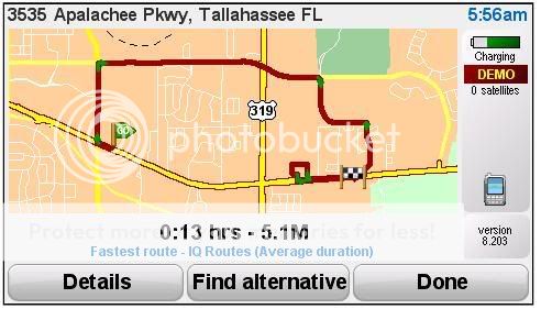
OK. Now explain this one. On the way home, I wanted to check the location of 7-11 on Recker Highway in Winter Haven, FL. It's on the way home and I knew the poi was placed incorrectly from looking at the distance (showed .7 miles when I was sitting next to it.) Anyway, I set it as a destination and got the screwiest route I've seen yet. The poi shows as being at Recker Highway and Hatfield road in Winter Haven. So try starting from 2099 42nd St NW in Winter Haven and navigation to that 7-11 (Gas station in the poi's). Tell me what you see.
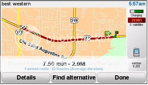
Same deal as before. U-Turn avoidance. Yup.
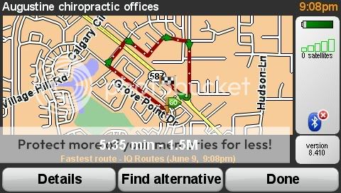
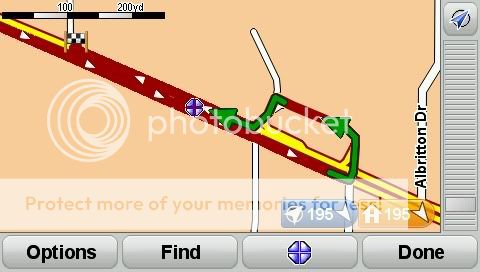
The address for the 7-11, right or wrong (and it is wrong), is set up at 4000 Recker Highway. So we're working with that, as you described above, as our destination. The place is actually RSG at 4003. There isn't a 4000 Recker. But it makes an interesting test case.
Take a look at the 4000 Recker address on Google maps. That puts it on the N side of Recker, just
SE of the Hatfield intersection. So far, so good.
However (man, I love that word when talking TT) ... Google (and hence, TeleAtlas) shows that as you travel SE on Recker, it becomes a
divided highway about 200'
prior to the Hatfield intersection and continues as such until just beyond Jay Phyle Place. I see nothing in the satellite photo that would indicate any reason for them to have called it divided, but there it is all the same.
Right or wrong, that's what the map indicates, and is what your TomTom is responding to.
Note: Google maps isn't as A.N.A.L. about U-turns, and that's how it gets you there, using the intersection at Jay Phyle to turn you around.